

Texas offers a diverse range of natural scenery, making it a prime destination for both novice and seasoned hikers. The state is home to impressive mountain landscapes, dramatic canyons, and countless state parks, each with unique trails for every skill level.
From well-known routes in Big Bend National Park to hidden pathways winding through lush forests and along scenic lakes, there are options to suit any outdoor enthusiast. Whether someone is looking for an easy walk or a full-day challenge, Texas provides hiking trails that showcase the state’s natural beauty.
1. Summit Path to Guadalupe Peak, Guadalupe Mountains National Park
The trek to Guadalupe Peak, known as the highest point in Texas at 2,667 meters (8,751 feet), attracts hikers eager for a rewarding challenge. The route, starting from Pine Springs Campground, covers approximately 8.4 miles in total. Most hikers will need between 6 and 8 hours to finish the trip, depending on pace and rest stops.
Highlights of the trail include:
- Stunning panoramic views of both the rugged mountains and the open desert
- Shifts in terrain, from stone-filled paths to shaded forest sections
- Opportunities to spot native plants and local wildlife
- Informative signs describing the flora, fauna, and history of the park
The climb to the summit is demanding, featuring steep slopes and rocky stretches. Proper footwear and plenty of water are essential. At the top, visitors will find a stainless-steel pyramid marking the peak—a unique feature with its own story.
For those seeking a memorable day hike, Guadalupe Peak Trail offers both a physical test and scenic rewards throughout Guadalupe Mountains National Park.
2. South Rim Route, Big Bend National Park
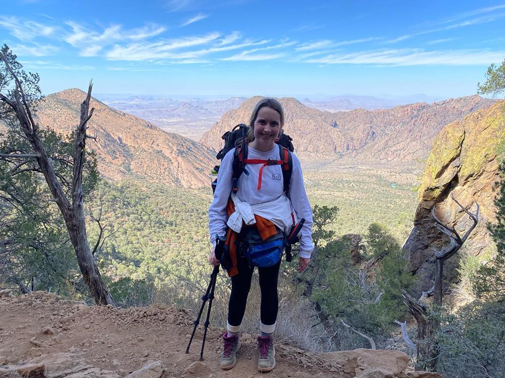
The South Rim Route stands out as a premier hiking experience in Big Bend National Park, known for its sweeping scenery and variety of landscapes. Starting at the Chisos Basin trailhead, visitors encounter a mix of shaded forests, colorful wildflower meadows, and arid desert stretches as they ascend. Most hikers cover the distance—a loop of about 12 to 14.5 miles—in six to eight hours, making it suitable for a dedicated day hike.
Key Features:
- Length: 12–14.5 miles (loop)
- Estimated Time: 6–8 hours
- Trailhead: Chisos Basin
- Elevation Gain: Steady, with long uphill portions
Hikers are rewarded with panoramic views from the rim itself, where the Chihuahuan Desert spreads out below and distant mountains rise on the horizon. On clear days, it’s possible to look into Mexico, adding to the sense of vastness. Wildlife sightings are not uncommon; birds of prey often soar overhead, and the observant might spot distant mammals like black bears or mountain lions.
Spring and fall provide the mildest weather for tackling this route. Early starts are advisable to beat the heat and avoid finishing after sunset. For those staying overnight, camping along the South Rim offers a unique chance to experience Big Bend’s legendary dark skies—perfect for stargazing.
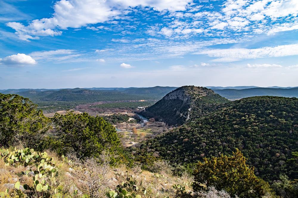
3. Scenic Route to Gorman Falls, Colorado Bend State Park
Set in Texas Hill Country, the Gorman Falls Trail leads hikers through a picturesque landscape at Colorado Bend State Park. The pathway starts close to the park’s main entrance, making access straightforward for all visitors. Covering approximately 2.6 miles for the round trip, the route is suitable for most hikers seeking a morning or afternoon excursion.
Trail Features:
- Distance: 2.6 miles round trip
- Difficulty: Moderate, with rocky terrain near the falls
- Highlights: Unique plant life, possible wildlife sightings, and a dramatic waterfall
Hikers will notice a variety of native plants, including cacti and wildflowers along the trail. It’s common to spot local wildlife such as deer or armadillos, adding interest to the journey. The final stretch becomes rockier and slippery, so sturdy footwear is recommended for safety.
The main attraction is Gorman Falls, where water drops around 70 feet over vibrant moss and rock. The area features viewing platforms, allowing visitors to enjoy the waterfall and capture photos without disturbing the environment.
Families often enjoy this hike, but adults should supervise children due to uneven ground. Gorman Falls is considered a “living” waterfall, with moss and formations that grow and shift over time, offering a fresh scene on every trip.
4. Trail to the Summit of Ol’ Baldy, Garner State Park
Mount Ol’ Baldy Trail is an energetic path in Garner State Park, situated in south-central Texas, roughly ninety minutes from San Antonio. Beginning at the main visitor center, the trail offers an accessible starting point for explorers of all experience levels. While only about 1 mile in total length (round trip), the route is known for its pronounced elevation gains and rocky terrain.
Hikers wind through thick forests, encountering a diverse range of birds and small wildlife. The climb grows more challenging as the path becomes steeper and rockier, which can require careful footing. Proper footwear and a steady pace are recommended, especially for those unfamiliar with rugged trails.
At the top, visitors are greeted with wide, panoramic views of the Texas Hill Country and the iconic Frio River. These vistas are especially memorable during sunrise or sunset, providing natural backdrops for photographs.
Key trail features:
| Trail Length | Difficulty | Recommended For | Notable Views |
|---|---|---|---|
| 1 mile (total) | Steep & rocky | Enjoys a physical challenge | Texas Hill Country, Frio River |
Along the way, educational signs describe the region’s unique plants and wildlife. Mount Ol’ Baldy is a favorite among park guests, so encountering fellow hikers is common. For those wishing to continue adventuring, the nearby Foshee Trail offers an easy extension from the same trailhead.
5. Lighthouse Route, Palo Duro Canyon Park
The Lighthouse Trail in Palo Duro Canyon State Park is a well-known path that draws visitors with its colorful geology and dramatic scenery. Stretching about 5.9 miles for a round-trip, it offers a satisfying outing for walkers of many abilities, starting conveniently near a main parking area.
As hikers make their way along the trail, they move through striking canyon landscapes marked by layered cliffs, arid terrain, and the expansive vistas unique to the Texas Panhandle. Sightings of local wildlife such as roadrunners, deer, and occasionally coyotes add extra interest to the journey.
Highlights of Lighthouse Route:
| Detail | Description |
|---|---|
| Distance | ~5.9 miles round trip |
| Estimated Time | Around 2 hours for most |
| Terrain | Mostly gentle, some elevation change |
| Main Attraction | Lighthouse rock formation |
The trail’s namesake, the Lighthouse formation, stands out like a towering natural monument—making it a favorite spot for a break or photos. Because temperatures can soar and shade is limited, visitors should carry plenty of water and come prepared for the sometimes harsh but beautiful environment.
6. Lone Star Hiking Path, Sam Houston National Forest
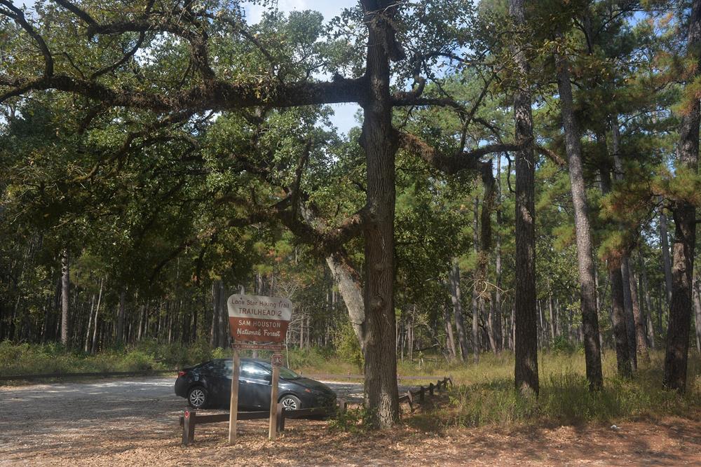
Located about sixty miles north of Houston, the Lone Star Hiking Trail stretches over 96 miles, making it the longest continuous hiking trail in Texas. This extensive path weaves through the Sam Houston National Forest, providing hikers with a peaceful and immersive outdoor experience.
The trail is segmented, allowing visitors to explore portions based on their ability and schedule. While some take on multi-day treks with overnight camping, others opt for shorter out-and-back segments. The terrain ranges from piney woods and hardwood forests to scenic meadows and stream crossings.
Wildlife sightings are frequent—deer, armadillos, and various bird species are often spotted along the path. Spring wildflowers and autumn foliage add seasonal beauty, making it appealing year-round.
Trail Information Table
| Feature | Detail |
|---|---|
| Total Length | 96.4 miles |
| Common Starting Point | Near Richards, TX |
| Terrain | Forest, creeks, meadows, lakes |
| Difficulty | Moderate |
| Wildlife | Deer, squirrels, birds |
| Best Time to Visit | Fall to spring |
7. Exploring Santa Elena Canyon Path, Big Bend National Park
Santa Elena Canyon Trail is one of the most iconic short hikes in Big Bend National Park. The trail begins at the end of Ross Maxwell Scenic Drive and offers access to breathtaking views of 1,500-foot limestone cliffs framing the Rio Grande River.
Though the hike is relatively short—1.6 miles round trip—it includes a mix of terrain, such as sandy sections, steps, and a crossing of Terlingua Creek, which may vary in water level depending on the season.
Trail Features:
- Distance: 1.6 miles round trip
- Difficulty: Easy to moderate
- Scenery: River views, towering canyon walls, desert vegetation
The narrow slot between the cliffs and the tranquil river below provide one of the most dramatic and photogenic landscapes in the park. It’s a favorite for families and photographers alike, and wildlife such as birds and butterflies may add to the magic.
8. Caprock Canyons Trailway, Caprock Canyons State Park
View this post on Instagram
The Caprock Canyons Trailway spans roughly 64 miles across the rugged beauty of Caprock Canyons State Park. It follows an old railroad route, passing through dramatic red rock formations, prairies, and rail tunnels.
The trail is divided into segments ranging from 5 to 12 miles, making it accessible for both short hikes and multi-day excursions. Highlights include sweeping views of the Caprock Escarpment, occasional sightings of the park’s Texas State Bison Herd, and wide-open skies ideal for photography.
Key Highlights:
- Multiple Segments: The trail is divided into manageable segments, typically ranging from 5 to 12 miles, making it convenient for both short walks and longer treks.
- Diverse Scenery: Hikers encounter expansive prairies and striking red rock canyons.
- Historic Elements: Travel passes through old railway tunnels, introducing a sense of adventure and history.
| Feature | Details |
|---|---|
| Total Distance | ~64 miles |
| Sections | 5–12 miles each |
| Notable Landmarks | Railroad tunnels, red rock vistas |
The park’s remote location means visitors should come well-prepared, especially for long hikes. With the changing terrain and elevation, this trail offers a true backcountry hiking adventure in the Texas Panhandle.
9. Great Escape Path, Muleshoe Bend
Located near Lake Travis, the Great Escape Trail in Muleshoe Bend Recreation Area offers a 6.5-mile loop well-suited for hiking and mountain biking. The trail is relatively flat and features wide paths, making it ideal for families and beginners.
The standout feature is the spring wildflower bloom, particularly the famous Texas bluebonnets, which cover the fields in brilliant color. The loop hugs the lake shoreline in places, offering peaceful lake views and opportunities for birdwatching.
Trail Highlights:
| Feature | Description |
|---|---|
| Trail Length | 6.5 miles (loop) |
| Activities | Hiking, Biking |
| Terrain | Mostly flat, wide |
| Scenic Points | Lake views, wildflowers |
| Best Season for Flowers | Spring |
Regular picnic stops are located along the path, making it easy to rest or enjoy a meal surrounded by nature. Additionally, campsites are available in the area, making overnight stays straightforward for those who want to spend more time in this peaceful part of central Texas. Campsites are close to the trail, so visitors can transition easily between hiking, biking, and relaxing at their camp.
10. Ron Coleman Challenge Trail, Franklin Mountains Park
The Ron Coleman Trail in Franklin Mountains State Park, located in El Paso, is known for its strenuous terrain and stunning desert views. The 7-mile route starts at McKelligon Canyon and ends near Smugglers Pass, climbing rugged terrain that requires both endurance and preparation.
This trail includes steep ascents, loose rock, and sections where hikers may use chains bolted into the rock for safety. Despite the challenge, it rewards with sweeping views of El Paso, New Mexico, and beyond.
Highlights include:
- Sweeping views of the desert, El Paso, and vistas stretching toward Mexico
- Encounters with native plants such as cacti, as well as the chance to spot resident wildlife like lizards and desert birds
- The rewarding summit at South Franklin Mountain, known for its panoramic scenery
| Difficulty | Distance | Estimated Time | Terrain | Notable Features |
|---|---|---|---|---|
| Strenuous | 7 miles | ~5.5 hours | Rocky, steep, some chain-assisted areas | Panoramic views, desert wildlife, marked route with signs/cairns |
An early start, plenty of water, and good footwear are essential. This hike is best for experienced hikers seeking a physical challenge and incredible summit scenery.
11. Eagle Mountain Lake Park Hiking Path
View this post on Instagram
Just northwest of Fort Worth, Eagle Mountain Lake Park offers a well-maintained 7.5-mile loop trail through a mix of shaded forest and open views of the lake. With modest elevation gain, this trail is suitable for most skill levels.
Benches and scenic overlooks are placed throughout, making it a relaxing but active hike. Spring wildflowers and lake breezes enhance the natural experience.
| Distance | Estimated Time | Elevation Gain | Trail Type |
|---|---|---|---|
| 7.5 miles | ~2 hr 45 min | Moderate | Loop |
This trail combines accessibility with serene lake views, making it popular with both locals and visitors.
12. Fate Bell Rock Art Path, Seminole Canyon State Park
The Fate Bell Trail in Seminole Canyon State Park, near Comstock, is a guided experience that explores some of Texas’s most fascinating prehistoric rock art. At only 1 mile round trip, this moderate trail descends into Seminole Canyon and features pictographs created by ancient Native peoples thousands of years ago.
The tour is only available with a guide, and photography is permitted (without flash), but touching the artwork is strictly prohibited.