
Texas is home to a surprising array of scenic canyons that offer unique experiences for both seasoned hikers and those new to the trails. Beyond its well-known culture and bustling cities, the state features these remarkable natural landscapes where visitors can explore on foot.
From dramatic overlooks to paths winding through rugged terrain, each canyon has its own character and set of challenges. These ten canyons provide plenty of opportunities for adventure and discovery, making them notable highlights in Texas for anyone interested in outdoor exploration.
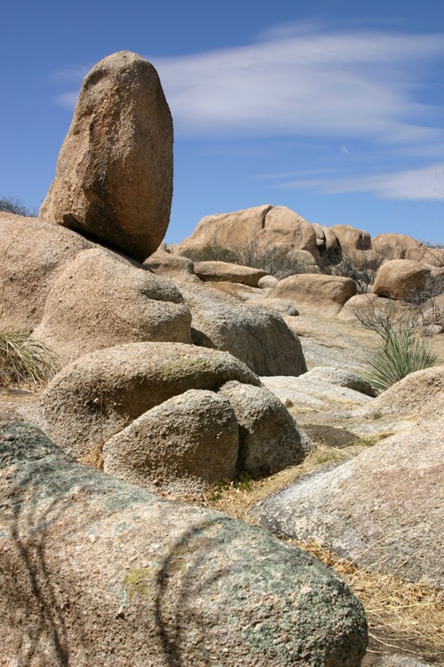
1. Exploring Palo Duro Canyon
Palo Duro Canyon, set in the Texas Panhandle close to Amarillo and the town of Canyon, spans nearly 120 miles in length and plunges as deep as 800 feet. The landscape stands out with its vivid, layered rock colors and dramatic, steep cliffs. Visitors frequently refer to it as “The Grand Canyon of Texas.”
Popular Activities in Palo Duro Canyon:
- Hiking
- Scenic drives
- Wildlife observation
A highlight of the park is the Lighthouse Trail. This well-marked path covers 6 miles round trip and draws hikers to a striking rock tower that resembles a lighthouse. The walk is generally rated moderate, but it features a challenging climb near the end. For more strenuous options, the Rock Garden Trail provides a rugged journey with rewarding panoramic viewpoints.
Wildlife sightings are common. Deer, wild turkeys, and, in springtime, colorful wildflowers can all be seen from the trails.
| Feature | Details |
|---|---|
| Location | Texas Panhandle |
| Total Length | ~120 miles |
| Maximum Depth | ~800 feet |
| Most Noted Trail | Lighthouse Trail (6 miles roundtrip) |
| Notable Wildlife | Deer, wild turkeys, wildflowers |
2. McKittrick Canyon
Nestled within Guadalupe Mountains National Park, McKittrick Canyon stands out for its striking contrast of desert and lush greenery. This area reveals a rich mix of plant species, with vibrant bigtooth maples and hardwoods creating a tapestry of color, especially in autumn. The canyon’s environment supports not only classic desert flora like yucca and agave but also a variety of wildlife.
Trail Highlights
- Trailhead: Begins at the McKittrick Canyon Visitor Center
- Total Distance: 4.8 miles round trip to Pratt Cabin
- Terrain: Dry stream beds shifting to forested canyon
The walk to the historic Pratt Cabin includes several stream crossings and frequent opportunities to spot local fauna such as mule deer and songbirds. Built by a geologist and donor to the National Park Service, Pratt Cabin offers hikers a peaceful and scenic destination.
For those seeking a unique experience in West Texas, this canyon provides both tranquility and remarkable biodiversity.
3. Santa Elena Canyon
Santa Elena Canyon forms one of the most dramatic landscapes in Big Bend National Park, with limestone cliffs rising up to 1,500 feet above the Rio Grande. Hikers commonly follow the Santa Elena Canyon Trail, which starts at the end of Ross Maxwell Scenic Drive.
The path itself challenges visitors with a brisk, steep climb shortly after the start, followed by a descent toward the water’s edge. Trail length is approximately 0.8 miles each way, making it manageable for most skill levels.
Notable features:
- Towering canyon walls
- River scenery
- Trailhead accessibility
| Trail | Distance (one-way) | Notable Challenges |
|---|---|---|
| Santa Elena Canyon Trail | 0.8 miles | Steep initial climb; possible creek flooding |
Trail access may depend on weather, since flooding at Terlingua Creek can temporarily block the route. The experience offers unmatched views and a close look at the area’s dramatic geology, shaped in part by the nearby Terlingua Fault.
View this post on Instagram
4. Seminole Canyon
Seminole Canyon in Val Verde County features striking canyon scenery and centuries-old rock art. The park is especially noted for its ancient pictographs, with many dating back thousands of years and providing insight into early inhabitants of the region.
Highlights include:
- Canyon Rim Trail: A 4-mile path offering panoramic views of the Rio Grande and rugged canyons.
- Guided Fate Bell Shelter tours: Access rare rock paintings considered some of the oldest Indigenous pictographs in North America.
- Wildlife spotting: Visitors may encounter distinctive desert plants and native animals found only in this arid landscape.
The challenging hike to Fate Bell Shelter is rewarded by seeing prehistoric artwork firsthand. Seminole Canyon remains a unique destination for both history enthusiasts and outdoor explorers, merging cultural heritage with scenic vistas.
5. Caprock Canyons
Caprock Canyons State Park, located near Quitaque in the Texas Panhandle, is recognized for its striking red rock landscapes and as home to the state’s official bison herd. The park provides almost 90 miles of marked trails for hiking, biking, and horseback riding enthusiasts.
Popular Trails:
- Eagle Point Trail: A 2-mile route leading visitors to the picturesque Natural Bridge.
- Haynes Ridge Overlook: A challenging option with steep ascents and expansive canyon views.
Wild bison occasionally cross the trails, offering a unique wildlife experience. The historic Clarity Tunnel attracts attention in summer when thousands of Mexican free-tailed bats emerge at dusk.
With its variety of routes and rich natural scenery, Caprock Canyons stands out as a notable destination for outdoor recreation in Texas.
6. McKelligon Canyon
McKelligon Canyon sits on the southeastern edge of the Franklin Mountains in El Paso and attracts outdoor enthusiasts year-round. Visitors often enjoy activities such as hiking, rock climbing, running, and biking within this distinctive desert setting. The rugged landscape is particularly appealing for climbing due to its natural crevices and rock formations.
Popular activities include:
- Challenging hikes on the Ron Coleman Trail
- Scenic walks and runs along paved and natural paths
- Rock climbing routes suited for various skill levels
The Ron Coleman Trail begins at the end of McKelligon Canyon Road and typically requires a few hours to complete, rewarding hikers with impressive panoramic desert views.
Additionally, the canyon features a sizable amphitheater with over 1,500 seats, hosting performances like ‘Viva El Paso!’ during the summer months.
7. Mariscal Canyon
Mariscal Canyon stands out within Big Bend National Park for its remote cliffs and dramatic scenery. The 6.5-mile Mariscal Rim Trail gives hikers views across rugged limestone walls and down to the Rio Grande, making it a highlight for those seeking solitude and striking landscapes.
Trail Overview:
| Trail Name | Length | Difficulty | Unique Features |
|---|---|---|---|
| Mariscal Rim Trail | 6.5 miles (RT) | Moderate/Strenuous | Limestone cliffs, desert views |
A high-clearance vehicle is required to reach the trailhead due to challenging road conditions. The initial part of the hike is manageable, but the ascent becomes steeper as it nears the rim.
Along the route, hikers may spot distinctive desert flora, such as silverspine cholla. Water, sun protection, and an early start are all essential, as shade is limited throughout the trek.
View this post on Instagram
8. Boquillas Canyon
Boquillas Canyon stands out in Big Bend National Park for its impressive length and depth, with rugged limestone walls that soar up to 1,200 feet. The Boquillas Canyon Trail, an accessible 1.4-mile out-and-back route, begins at the end of Boquillas Canyon Road and gently climbs before dropping down toward the Rio Grande.
Key highlights of the Boquillas Canyon experience:
- Scenic vistas: Sweeping views greet hikers at the canyon’s iconic entrance.
- Geological and historical interest: Fossil remains and ancient grinding holes offer glimpses into the area’s natural and human history.
- Practical tips: Due to high temperatures, hikers should bring extra water and protection from the sun.
The calm river, the dramatic rock faces, and the changing light make this canyon an exceptional site for photography and quiet exploration.
9. Canyon Lake Gorge
Canyon Lake Gorge in Comal County is known for its striking geological features, formed rapidly during a major flood in 2002. Spanning 64 acres, the gorge reveals layers of limestone, ancient marine fossils, and clear dinosaur footprints estimated to be over 100 million years old.
Visitors can explore a well-marked, easy trail about a mile long, making it accessible for most fitness levels. Guided walks typically last around three hours and highlight the gorge’s formation, exposed rocks, and rich fossil history.
Notable sights along the route include cascading waterfalls, natural springs, and intricate rock structures. These features make Canyon Lake Gorge a unique destination for those interested in geology and natural history.
10. Eagle Nest Ravine
Eagle Nest Ravine, also known as Mile Canyon, stretches for about a mile near the town of Langtry and connects to the Rio Grande. The area is renowned for its archaeological relevance, particularly at Bonfire Shelter, where ancient inhabitants used sophisticated methods such as bison jumps for hunting. Its impressive history places it within the Lower Pecos Canyonlands Archeological District.
Although entry into the ravine is not permitted for hiking, visitors can enjoy panoramic views from designated lookout points in the Langtry area. Wildlife watchers might be interested to know the canyon is named after a pair of golden eagles that once nested nearby.
Key Facts
| Feature | Details |
|---|---|
| Alternate Name | Mile Canyon |
| Location | Near Langtry, Texas |
| Length | Approximately one mile |
| Notable Wildlife | Golden eagles |
| Archaeological Sites | Bonfire Shelter |
Eagle Nest Ravine remains an important site for those interested in Texas history and scenic landscapes.