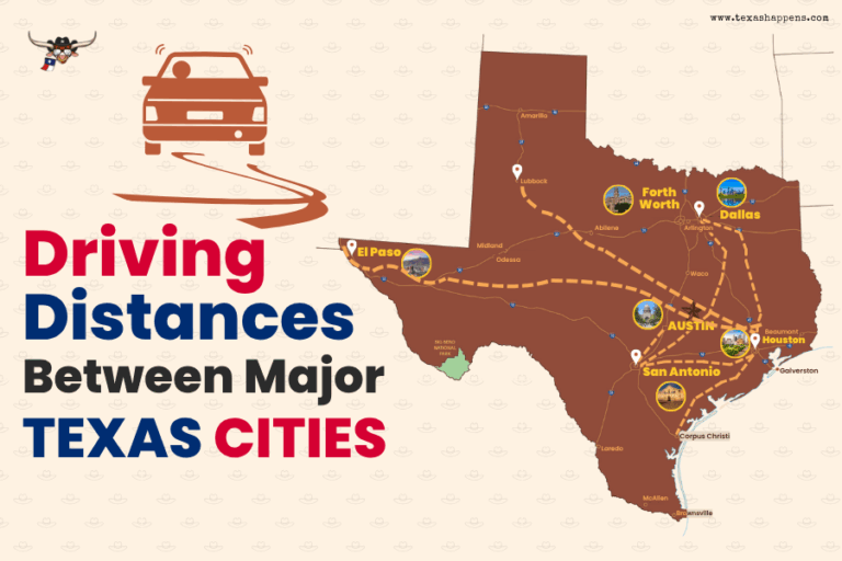
Texas’s major cities are interconnected by an extensive network of interstate highways and US routes. You’ll find I-35 serving as a crucial north-south corridor, connecting San Antonio to Austin in just 80 miles.
When you’re traveling between Houston and Dallas, I-45 provides a direct 240-mile route through rural Texas highways. For east-west travel, I-10 and I-20 offer indispensable connections across the state, while US-59 and US-83 provide additional intermodal transportation options.
If you’re heading to South Texas, US-77 links Corpus Christi to Brownsville along a 155-mile stretch. These major routes secure efficient travel between Texas’s metropolitan areas, with cities like El Paso and Amarillo connected by I-40, requiring about 4.5 hours of driving time. The Texas Highway Department established in 1917 laid the foundation for this extensive modern highway system that connects major population centers.
Dallas to Houston: The Interstate 45 Corridor

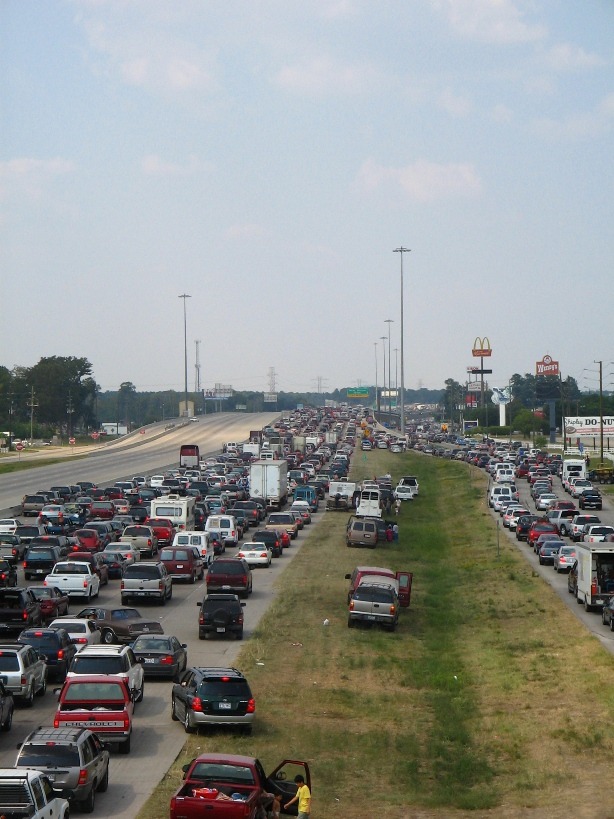
Image: Ashish from Houston, TX, I-45 & Louetta Rita Evacuation, CC BY 2.0
When traveling between Dallas and Houston, Interstate 45 serves as the primary corridor, spanning 239 miles through the heart of Texas. You’ll typically spend 3.5 to 4.5 hours on this route, which has seen significant transportation infrastructure upgrades in recent years.
Along the way, you’ll pass through charming towns and cities that offer scenic roadside attractions worth exploring:
- Stop in Corsicana to stretch your legs and sample their famous fruitcakes
- Visit the towering 67-foot Sam Houston statue in Huntsville
- Take a short detour to the George Bush Presidential Library in College Station
The I-45 corridor takes you through diverse panoramas, from the urban sprawl of The Woodlands to peaceful rural stretches of north central Texas, making your sightseeing both efficient and interesting.
The route eventually leads to Houston’s NRG Stadium, home of the NFL’s Houston Texans since 2002 and host to multiple Super Bowl championships.
Austin to San Antonio: The Central Texas Connection

The quick 80-mile trip from Austin to San Antonio along Interstate 35 represents one of Texas’s most crucial transportation connections. You’ll typically spend about an hour and fifteen minutes on this route that links the state capital with America’s seventh largest city.
Traffic patterns along this vital corridor reflect the region’s dynamic growth, as thousands of commuters, tourists, and business travelers make the odyssey daily. The economic impact of this central Texas artery can’t be understated – it connects two major metropolitan areas that drive the state’s prosperity.
Heading south to investigate San Antonio’s attractions or north to conduct business in Austin, you’ll find yourself among many others making this essential trek between these powerhouse cities.
Travelers seeking a longer journey can continue north from Austin to Dallas, where the Texas Hill Country provides scenic views during the 200-mile drive.
Major East-West Routes Across Texas
Spanning vast distances across the Lone Star State, major east-west routes showcase Texas’s astonishing width, with cities like El Paso and Beaumont sitting over 670 miles apart. You’ll find several important corridors connecting Texas cities, including the interstate 20 corridor that links Dallas to Midland in just over 4 hours.
While north south Texas routes connect cities like Amarillo to Corpus Christi, the east-west pathways reveal Texas’s tremendous scale:
- El Paso to Beaumont: 671 miles, crossing nearly the entire state
- Lubbock to Houston: 515 miles, connecting West Texas to the Gulf Coast
- Laredo to Wichita Falls: 534 miles, spanning from the Mexican border to North Texas
These routes demonstrate why you’ll need to plan ahead for long-distance treks across Texas, as many expeditions require full-day commitments. Speed limits along these routes vary considerably, with some stretches allowing drivers to cruise at 80 mph on interstates while others require slower speeds through cities.
El Paso’s Distance From Other Texas Metros
Located at Texas’s western edge, El Paso stands remarkably distant from other major metropolitan areas in the Lone Star State. El Paso’s remote location means you’ll need to drive significant distances to reach any other Texas city. You’re looking at nearly 600 miles to Dallas or Houston, and even San Antonio requires an exhausting 8-hour and 45-minute trek covering 564 miles.
El Paso’s geographic isolation is particularly evident when you consider that Midland, the nearest major Texas city, is still 268 miles away. If you’re heading to the state capital, you’ll face a 585-mile expedition to Austin, though the air distance is slightly shorter at 521 miles. This physical separation from other Texas metros makes El Paso unique among the state’s major cities.
Coastal City Connections: Houston to Corpus Christi

Image: Terry Ross, Corpus Christi bay, CC BY-SA 2.0
As you travel south along Texas’s Gulf Coast, you’ll find two major port cities connected by a relatively straightforward 213-mile route. While the straight-line distance between Houston and Corpus Christi is just 180 miles, the driving route follows Interstate 45 South before shifting to State Highway 35 South, serving as one of the region’s primary hurricane evacuation routes.
For your expedition between these coastal cities, keep in mind:
- The trip typically takes about 3 hours and 15 minutes under normal conditions
- The route offers glimpses of coastal city scenery as you approach Corpus Christi
- Traffic conditions and construction can affect your travel time, so check updates before departing
These well-connected metropolitan areas represent pivotal economic hubs along Texas’s southern Gulf Coast, making this route indispensable for both commerce and tourism.
The Texas Triangle: Dallas-Houston-San Antonio

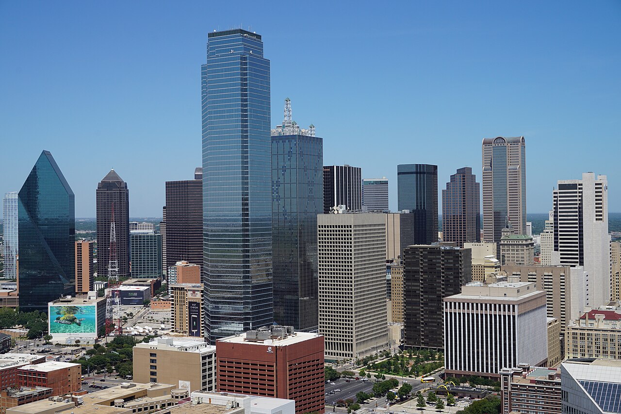
Image: Michael Barera, View of Dallas from Reunion Tower August 2015 13, CC BY-SA 4.0
Three major cities form the Texas Triangle, a paramount network of highways and economic corridors that connect Dallas, Houston, and San Antonio. Driving between each city covers approximately 300 miles, typically taking 4-5 hours along major interstates like I-35, I-45, and I-10.
The triangle’s economic importance can’t be overstated, as it links Texas’s three largest metropolitan areas. While the actual air distances are shorter – 240 miles from Dallas to Houston, 275 miles from Dallas to San Antonio, and 190 miles from Houston to San Antonio – the highway routes provide essential transportation infrastructure for both passengers and freight. You’ll notice the concentrated business activity within this region, making the Texas Triangle a pivotal driver of the state’s economy.
West Texas Travel Times and Distances
Traversing West Texas requires careful planning due to the vast distances between major cities. When you’re exploring remote West Texas transportation routes, you’ll need to account for significant travel times between destinations. Those tumbleweed-filled highway drives can stretch from 1.5 hours to 5 hours, depending on your route.
Consider these key travel times for your West Texas expedition:
- El Paso to Odessa takes about 4 hours and 7 minutes, covering 283 miles
- Midland to Lubbock spans 118 miles, requiring 3 hours of drive time
- Wichita Falls to El Paso is the longest stretch at 582 miles, demanding 8.5 hours
For shorter trips, you can drive from Brownwood to San Angelo in just 1.5 hours, while Amarillo to Abilene requires a 3.5-hour commitment through the Texas plains.
Border City Routes and Mileage Charts

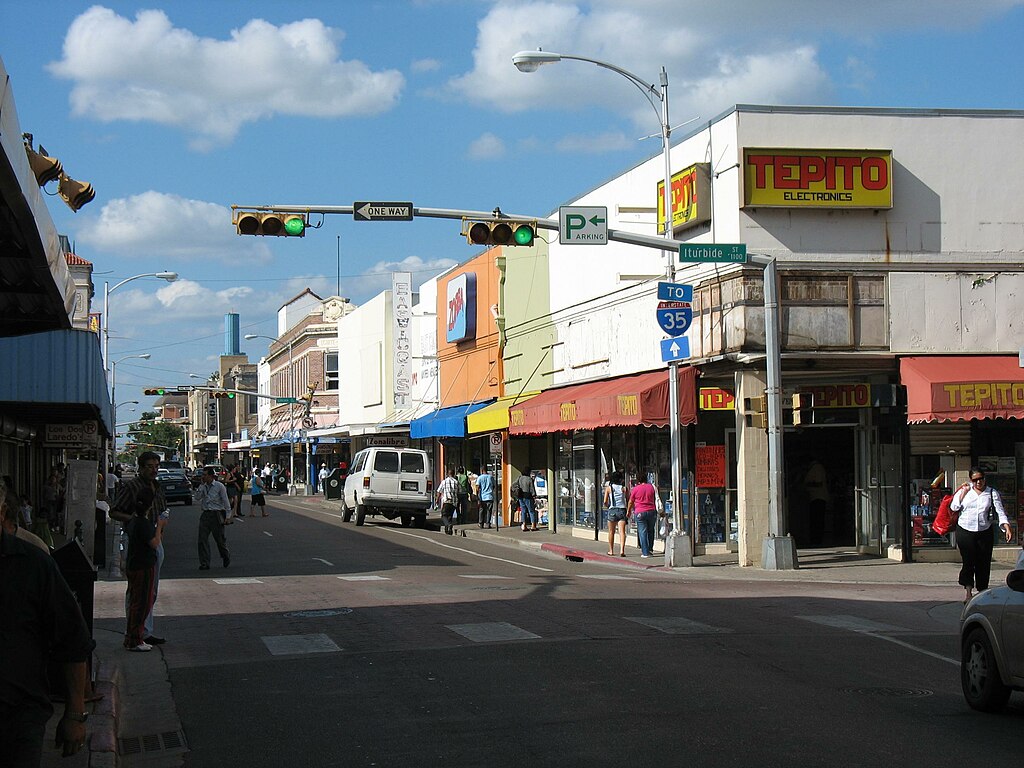
Image: Not home at en.wikipedia, Laredo Downtown, CC BY-SA 3.0
When planning travel along Texas’s southern border, you’ll need to ponder the unique variables of border city routes. The distances between Brownsville, Laredo, and El Paso require careful consideration, especially when crossing into their Mexican sister cities.
Mileage charts don’t tell the complete story of border city travel times. Border crossing considerations can profoundly impact your expedition, as customs procedures affect overall travel duration. When mapping your route between Texas border cities, you’ll want to factor in potential wait times at international bridges and crossing points.
To optimize your travel plans, consult updated mileage charts that specifically address cross-border routes. These resources will help you better estimate actual travel times and plan more efficient trips between Texas and Mexico border cities.
Planning Multi-City Texas Road Trips
Moving beyond single border crossings, multi-city road trips across Texas require smart planning tools and resources. You’ll find the Texas Mileage Chart and Distance Between States Calculator invaluable for mapping your expedition efficiently. These tools help you implement key route optimization strategies while uncovering gas saving tips for your extended drives.
Take advantage of these interactive features to enhance your trip planning:
- Calculate distances between up to 100 cities using exact coordinates or city names
- Save and share customized routes with fellow travelers
- Access detailed driving times and alternative paths between destinations
The thorough mapping system lets you visualize your entire adventure, making it simple to adjust your itinerary for maximum efficiency. Whether you’re exploring multiple cities or planning a cross-state exploration, these planning tools guarantee you’ll make the most of your Texas road trip.
Final Thoughts
Driving across Texas is an experience in itself, with long highways, shifting landscapes, and vibrant cities offering something unique at every stop. The distances between major Texas cities can be significant, but with proper planning, the journey can be just as rewarding as the destination.


