


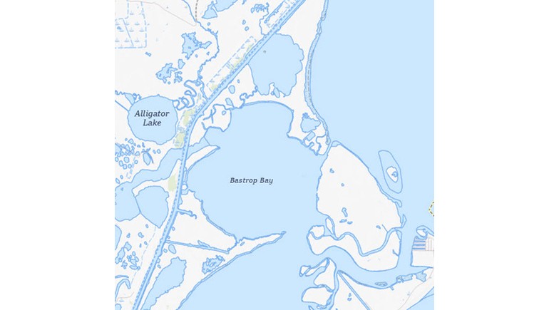
The Bastrop Bay Texas Map provides a geographic view of Bastrop Bay, a shallow coastal bay located in Brazoria County along the Texas Gulf Coast. Sourced from the U.S. Geological Survey, the map highlights an important part of the region's coastal waterways and surrounding landscape.
Location and Geography of Bastrop Bay
Bastrop Bay is situated southwest of West Bay and north of Christmas Bay, forming part of the greater Galveston Bay estuarine system. The bay covers approximately 2,000 acres and is relatively shallow, with a maximum depth of around five feet.
The surrounding landscape consists largely of low-lying coastal wetlands, salt marshes, and tidal flats. These natural features make the area an important part of the Texas Gulf Coast's coastal ecosystem.
Coastal Waterways and Connections
One of the important geographic features of Bastrop Bay is its connection to nearby coastal waterways. Bastrop Bayou supplies freshwater to the bay, while connections through Christmas Bay, Cold Pass, and San Luis Pass allow water to circulate between the surrounding bays and the Gulf of Mexico.
These waterways create a transitional environment where freshwater mixes with saltwater, supporting a variety of fish, shellfish, birds, and other coastal wildlife.
The Importance of Bastrop Bay
Bastrop Bay is part of an interconnected coastal environment that supports marine life and contributes to the ecological health of the surrounding region. Its shallow waters and nearby marshes provide important habitats for fish and other aquatic species.
The bay and its surrounding wetlands also help illustrate the natural geography of Brazoria County, where coastal waterways, barrier islands, and marshlands shape the landscape.
Understanding the Texas Coastal Landscape
The Bastrop Bay map serves as a useful geographic reference for understanding the arrangement of bays and waterways along the upper Texas coast. It highlights how smaller coastal bays form part of a much larger system connected to Galveston Bay and the Gulf of Mexico.
For those interested in Texas geography, coastal environments, and natural landmarks, the map provides a helpful look at one of the state's lesser-known coastal features.