


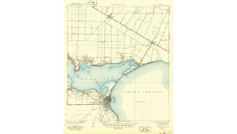
The 1925 Map of Corpus Christi, Texas, provides a historical look at the city's geography, transportation routes, and surrounding landscape during the early 20th century. Created by the United States Geological Survey (USGS), the map documents Corpus Christi and nearby areas at a time when the coastal city was developing as an important center for trade, transportation, and commerce in South Texas.
Corpus Christi in the 1920s
By 1925, Corpus Christi had become an established coastal community known for its maritime activities, agriculture, and growing commercial importance. Located along Corpus Christi Bay, the city benefited from its access to coastal waterways and transportation connections with inland Texas.
The 1920s marked an important period in the city's development. Construction of the Port of Corpus Christi was underway, preparing the area for expanded shipping and industrial activity. The port officially opened in 1926, helping establish Corpus Christi as a major maritime center.
Geographic Features and Coastal Landscape
One of the map's most important features is its representation of the coastal geography surrounding Corpus Christi. The area includes bays, waterways, and low-lying coastal land that influenced settlement patterns and transportation routes.
Corpus Christi Bay and Nueces Bay are major geographic features of the region. These bodies of water provided opportunities for fishing, shipping, and commercial activity while also shaping the location of roads and settlements.
The map offers a valuable reference for understanding the area's natural landscape before decades of urban expansion and coastal development.
Roads and Transportation in Early Corpus Christi
During the 1920s, transportation in Corpus Christi relied on a combination of roads, railroads, and maritime routes. These connections allowed residents and businesses to transport agricultural products, livestock, and other goods between coastal communities and inland markets.
Historical maps from this period help illustrate the development of transportation infrastructure before modern highways and expressways transformed travel throughout South Texas.
As Corpus Christi continued to grow, improvements to roads, bridges, and port facilities contributed to its increasing importance as a regional transportation hub.
Historical Importance of the Map
The 1925 Map of Corpus Christi preserves a geographic record of the city shortly before the opening of its deepwater port. It provides useful information about the surrounding terrain and the development of communities along the Texas Gulf Coast.
Comparing this historical map with modern maps reveals how Corpus Christi has expanded through residential development, industrial growth, and transportation improvements.
Today, the map serves as a useful reference for studying the city's early development, coastal geography, and transportation history. It also offers a glimpse of Corpus Christi during an important period in its transformation into one of Texas's major port cities.