
Hiking is one of the best ways to experience the region’s beauty up close. It allows you to explore hidden gems, enjoy breathtaking vistas, and connect with nature meaningfully.
And if you’re looking for somewhere to hike in Texas, one of the best places to start is in the Texas Hill Country. This Central Texas region is well-known for its stunning natural beauty and diverse landscapes that you would truly marvel at.
Why the Texas Hill Country is Perfect for Hiking
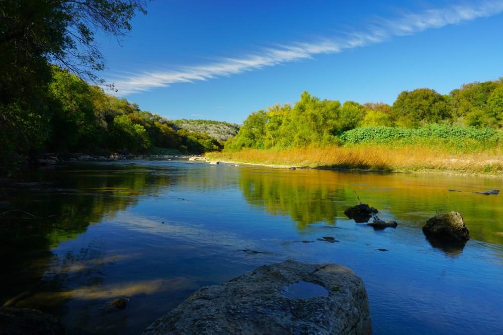
The Texas Hill Country is a hiker’s dream for several reasons. First, the geography in this area is diverse and unique. You’ll find everything from rugged hills and limestone cliffs to serene rivers and expansive grasslands. This variety ensures that there’s always something new to explore and new things to experience, no matter how many times you visit.
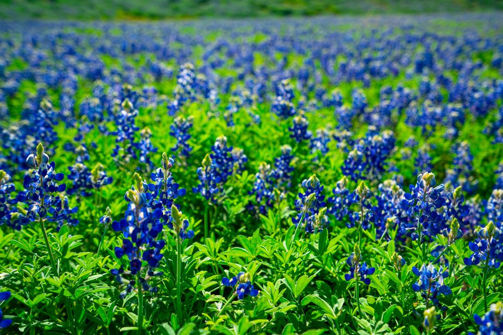
Besides its stunning landscapes, the Texas Hill Country is home to a wide array of flora and fauna. As you hike, you’ll encounter beautiful wildflowers and towering oak trees and perhaps even spot some wildlife like deer, armadillos, and various birds. The changing seasons bring different colors and sights, so you’ll surely have a different view if you visit again in another season.
Another reason the Texas Hill Country is ideal for hiking is its accessibility. Thanks to the region’s mild climate, you can enjoy hiking trails at any time of the year. Whether you prefer the cool, crisp winter air or the vibrant blooms of spring, there’s always a good time to hit the trails.
Best Places to Hike in the Texas Hill Country
Now, let’s take you on a journey through some of the best hiking trails in the Texas Hill Country.
Enchanted Rock State Natural Area
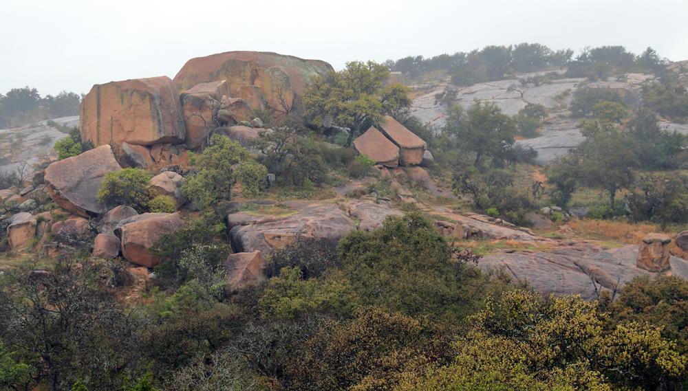
One of the crown jewels of the Texas Hill Country is the Enchanted Rock State Natural Area. This incredible spot is named after the massive pink granite dome that rises 425 feet above the surrounding landscape. It’s not just the rock itself that’s enchanting—it’s the whole experience of hiking here.
Key Features
The main trail to the summit of Enchanted Rock is the Summit Trail, which is about 0.8 miles one way. Don’t let the short distance fool you; it’s a steady uphill climb that can be quite challenging. But the effort is absolutely worth it. As you make your way up, you’ll be rewarded with stunning panoramic views of the Hill Country that stretch out for miles.
The area also offers several other trails that wind through diverse terrain, including rugged backcountry paths, scenic overlooks, and shaded forest areas. The Loop Trail, for instance, is a 4-mile trail that circles the entire park and gives you a comprehensive tour of its natural beauty.
One of the key attractions of Enchanted Rock is the opportunity to see it glow at sunset. The rock’s surface reflects the light in a way that makes it look like it’s glowing—an experience that’s truly magical. Additionally, the area is perfect for stargazing, thanks to its dark skies and minimal light pollution.
Difficulty
In terms of difficulty, the Summit Trail is rated as moderate to challenging due to its steep ascent and rocky terrain. It’s suitable for most hikers, but it’s a good idea to wear sturdy shoes and bring plenty of water, especially on hot days. For those looking for an easier hike, the other trails in the park offer a variety of difficulty levels.
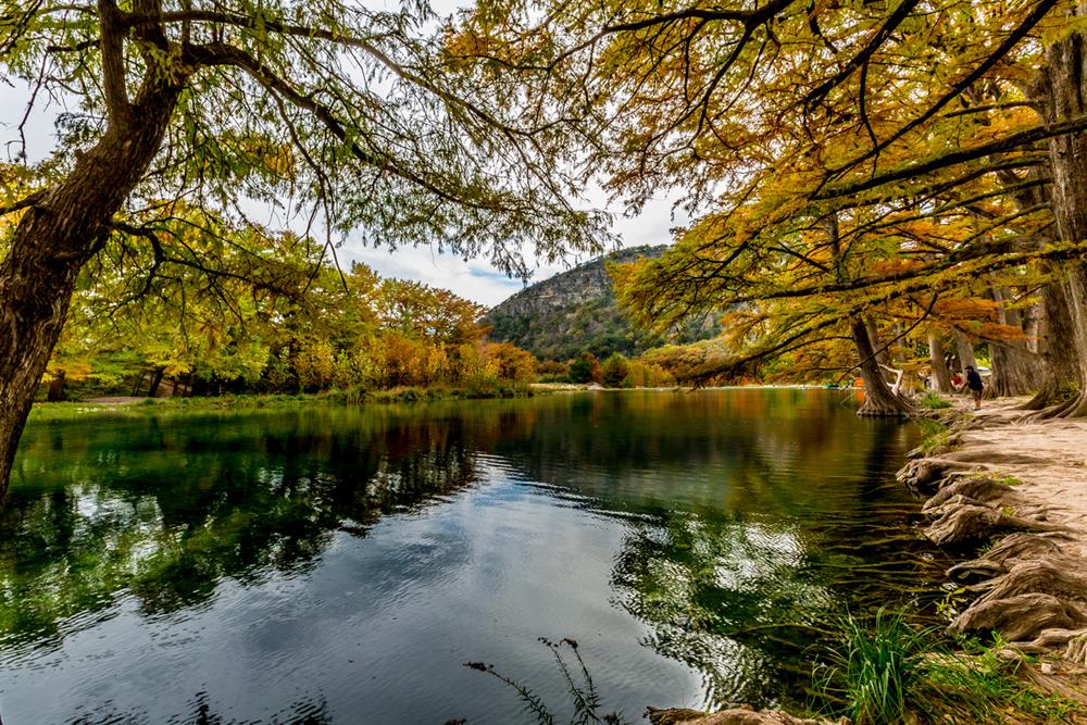
Lost Maples State Natural Area
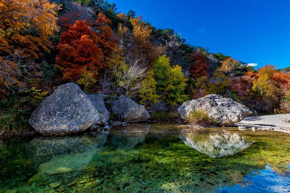
Lost Maples State Natural Area is a hidden gem in the Texas Hill Country, especially renowned for its stunning fall foliage. Located along the Sabinal River, this park offers a beautiful escape into nature with its unique landscape and diverse trails.
Key Features
Lost Maples features several trails, but the East Trail is one of the most popular. This trail is about 4.6 miles round trip and takes you through some of the most picturesque areas of the park. You’ll hike along the Sabinal River, through dense maple and oak forests, and up to high ridges that offer incredible views of the surrounding countryside.
During autumn, the maple trees turn vibrant shades of red, orange, and yellow, creating a stunning backdrop for your hike. It’s a sight you wouldn’t expect in Texas, making it a unique experience.
In addition to the fall colors, Lost Maples is home to several scenic overlooks, springs, and a small but beautiful waterfall. The park is also a haven for birdwatchers, with many species living here, including the rare golden-cheeked warbler.
Difficulty Level and Length
The East Trail is considered moderate in difficulty. It includes some steep and rocky sections, particularly as you climb to the ridge, but it’s manageable for most hikers with a moderate level of fitness. The trail is well-marked, making it easy to follow, even for beginners.
For those looking for a shorter or easier hike, the West Trail is another great option. It’s a 2.5-mile loop that offers beautiful views of the river and the surrounding forest without the steeper climbs.
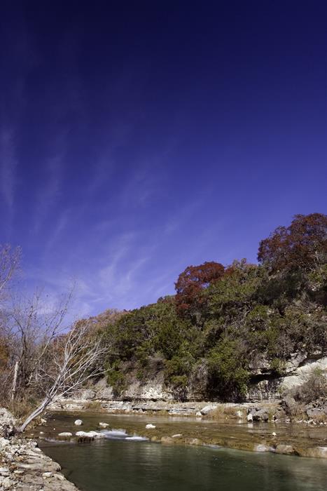
Pedernales Falls State Park
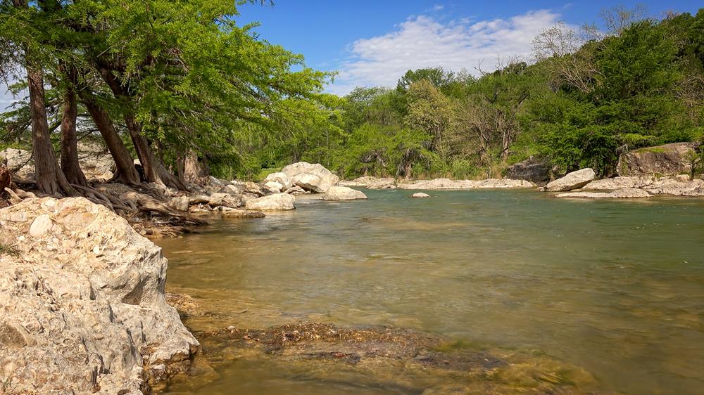
Pedernales Falls State Park is a must-visit destination for anyone who loves nature and scenic beauty. Nestled along the Pedernales River, this park is famous for its stunning waterfalls and diverse hiking trails.
Key Features
The most popular trail in Pedernales Falls State Park is the Pedernales Falls Trail System. This network of trails offers various routes, but the main attraction is the trail that leads to the falls themselves. The trail to the falls is about 0.5 miles one way and is relatively easy, making it accessible to hikers of all skill levels.
For those looking for a longer hike, the Wolf Mountain Trail is an excellent option. This 7.5-mile loop takes you through rugged terrain, offering beautiful views of the river and the surrounding hills.
The main attraction here is, without a doubt, the waterfalls. The Pedernales River cascades over massive slabs of limestone, creating a series of beautiful, tiered waterfalls. The falls are especially impressive after a good rain, but they’re picturesque year-round.
Difficulty Level and Length
The trails in Pedernales Falls State Park range from easy to moderate. The trail to the falls is short and easy, making it perfect for families and casual hikers. The Wolf Mountain Trail, on the other hand, is longer and more challenging, with some steep and rocky sections that require a bit more effort. However, it’s well worth it for the spectacular views and the chance to experience more of the park’s natural beauty.
Garner State Park
Garner State Park is a beloved destination in the Texas Hill Country, known for its scenic beauty and recreational opportunities. Located along the Frio River, this park offers a variety of hiking trails that cater to all levels of hikers.
Key Features
One of the most popular trails in Garner State Park is the Old Baldy Trail. This trail is a short but steep climb, about 0.5 miles one way, that takes you to the top of Old Baldy Hill. From the summit, you get a panoramic view of the park and the Frio River below. Another great option is the Frio Canyon Trail, a moderate 2.9-mile loop that winds through the canyon and along the river, offering beautiful views and plenty of shade.
The Frio River is the star attraction at Garner State Park. Its crystal-clear waters are perfect for swimming, tubing, and kayaking. The river is a great spot to cool off after a hike, and the park’s beaches and picnic areas make it easy to spend a full day enjoying the water.
The trails take you through shady oak and juniper forests, past limestone bluffs, and up to overlooks with sweeping views of the Hill Country.
Difficulty Level and Length
The trails in Garner State Park range from easy to challenging. The Old Baldy Trail, while short, is quite steep and can be strenuous, especially in the heat. It’s suitable for most hikers, but you’ll want to take it slow and be prepared for a bit of a workout. The Frio Canyon Trail is moderate in difficulty, with some rocky and uneven sections, but generally manageable for most hikers.
For those looking for an easier walk, the park has several shorter, flatter trails that are perfect for a leisurely stroll or a family outing. These trails still offer great views and access to the river without the more strenuous climbs.
Balcones Canyonlands National Wildlife Refuge
Balcones Canyonlands National Wildlife Refuge is a hidden treasure in the Texas Hill Country, known for its stunning scenery and excellent bird-watching opportunities.
Key Features
One of the most popular trails in the refuge is the Rimrock Trail. This 2.2-mile loop takes you through beautiful woodlands and up to high cliffs that offer sweeping views of the surrounding canyonlands. Another favorite is the Doeskin Ranch Trail, a network of shorter trails that can be combined for a longer hike, ranging from 0.6 to 2.7 miles.
If you’re into birdwatching, you’ll definitely have a blast here. Balcones Canyonlands is a paradise for bird watchers. The refuge is home to the endangered golden-cheeked warbler and black-capped vireo, among many other species. As you hike, you’re likely to hear and see a variety of birds, making it a perfect spot for nature enthusiasts. Plus, the stunning vistas of rolling hills, rocky outcrops, and lush valleys make it worth it.
Difficulty Level and Length
The Rimrock Trail is moderately difficult, with some steep sections and rocky terrain. It’s suitable for most hikers, but you’ll need to be prepared for a bit of a climb. The Doeskin Ranch Trail network offers options for all levels, from easy, flat trails to more challenging routes with varying elevations.
Milton Reimers Ranch Park
Milton Reimers Ranch Park is a fantastic destination in the Texas Hill Country, known for its diverse outdoor activities, including hiking and rock climbing. The park offers scenic trails and some of the best climbing spots in the region.
Key Features
One of the main trails in Reimers Ranch Park is the Canyon Trail. This trail runs along the Pedernales River and through a beautiful canyon, offering scenic views and access to the river. The trail is about 2.5 miles long and provides a mix of easy walking and more challenging sections.
Reimers Ranch is particularly famous for its rock climbing areas. The canyon walls are made of rock formations that can provide excellent climbing opportunities – coming with stunning views as your backdrop.
Then the Pedernales River is there as a great spot to relax and cool off after a hike. You can swim, fish, or even kayak here.
Difficulty Level and Length
The Canyon Trail is moderately difficult, with some rocky and uneven sections. It’s a great trail for most hikers, offering a good balance of challenge and scenic beauty. For those interested in rock climbing, the difficulty level of the routes varies widely, so there’s something for everyone, from beginners to advanced climbers.
Guadalupe River State Park
Guadalupe River State Park is a beautiful spot in the Texas Hill Country, offering a perfect blend of scenic trails and relaxing river views. It’s an ideal destination for hikers looking to enjoy the natural beauty and tranquil waters of the Guadalupe River.
Key Features
One of the standout trails in Guadalupe River State Park is the Bald Cypress Trail. This trail is about 2.86 miles long and winds along the banks of the Guadalupe River. It’s an easy-to-moderate trail that offers plenty of shade from the towering cypress trees, making it a pleasant hike even on warmer days. Another popular option is the Painted Bunting Trail, which is a shorter, 0.75-mile loop that offers beautiful wildflower views and bird-watching opportunities.
Of course, the key attraction of Guadalupe River State Park is the Guadalupe River itself. The river’s clear, cool waters are perfect for swimming, tubing, and fishing. The trail offers plenty of spots to stop and enjoy the river views, whether you want to dip your toes in the water or just relax on the banks.
Difficulty Level and Length
The Bald Cypress Trail is easy to moderate in difficulty, making it accessible for most hikers, including families with children. The terrain is mostly flat, with some gentle inclines. The Painted Bunting Trail is even shorter and easier, perfect for a quick and scenic walk.
For those looking for a bit more of a challenge, the park also offers the Barred Owl Trail and the Cedar Sage Trail, which are slightly more rugged but still manageable for most hikers.
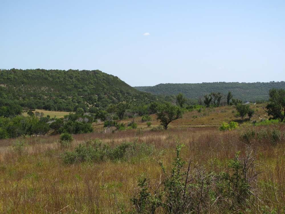
Hill Country State Natural Area
A true gem for outdoor enthusiasts, the Hill Country State Natural Area offers rugged beauty and a sense of tranquility that’s hard to find. Located near Bandera, Texas, this area is perfect for hikers who want to experience the raw beauty of the Texas Hill Country.
Key Features
One of the main trails in Hill Country State Natural Area is the West Peak Overlook Trail. This trail is approximately 3.5 miles long and takes you through diverse landscapes, including open grasslands, rocky hills, and shaded woodlands. The trail leads up to a stunning overlook where you can take in panoramic views of the surrounding countryside.
As you hike, you’ll pass through areas with beautiful wildflowers, especially in the spring and early summer. The trail also provides opportunities to see local wildlife, such as deer, wild turkeys, and a variety of birds.
One of the highlights of the trail is the overlook itself. From the top, you get a breathtaking view of the rolling hills and valleys that define the Hill Country. It’s a perfect spot to rest, take photos, and simply enjoy the serenity of nature.
Difficulty Level and Length
The West Peak Overlook Trail is moderately difficult. It includes some steep and rocky sections, particularly as you approach the overlook. The trail is well-marked and suitable for most hikers with a moderate level of fitness. But if you’re looking for an easier option, the park offers several shorter, less challenging trails that still provide beautiful scenery and a chance to explore.
Colorado Bend State Park
Colorado Bend State Park is a fantastic destination for hikers who love a mix of adventure and natural beauty. This park comes with many different trails, each with a unique set of attractions.
Key Features
One of the most popular trails in Colorado Bend State Park is the Gorman Falls Trail. This trail is about 3 3-mile round trip and takes you through diverse terrain, including rocky paths and shaded forest areas. The trail leads to the stunning Gorman Falls, a breathtaking 70-foot waterfall that cascades down moss-covered rocks.
The must-see attraction in this park is the Gorman Falls. The sight of the falls, with water tumbling down into a lush, green grotto, is truly mesmerizing. There are also caves to explore, such as the famous Gorman Cave.
The park also features the Colorado River, which is perfect for kayaking, swimming, and fishing. You’ll encounter various wildlife along the trails, including deer, armadillos, and a wide variety of birds.
Difficulty Level and Length
The Gorman Falls Trail is moderately difficult. The terrain can be rocky and uneven, and the final descent to the falls is quite steep, requiring careful footing. The trail is manageable for most hikers, but wearing sturdy hiking boots is recommended.
For those seeking a more challenging adventure, the park offers longer trails like the Spicewood Springs Trail, which is about 5.5 miles round trip and includes several creek crossings and scenic vistas.
Conclusion
The Texas Hill Country is naturally beautiful, offering countless opportunities for adventure for people who want to explore the great outdoors. Whether you’re a seasoned hiker or just starting out, there’s a trail here for you.