
Texas has four major natural regions or geographical areas that are set apart from its surrounding areas on the basis of its landforms, vegetation, and climates. Texas has hundreds of miles of coastline on the Gulf of Mexico and mountains that range to nearly 9,000 feet above sea level in the west. We can divide Texas’s natural regions into four parts: North-Central Plains, Great Plains, Mountains and Basins, and Coastal Plain.
Let’s talk about four of them in detail.
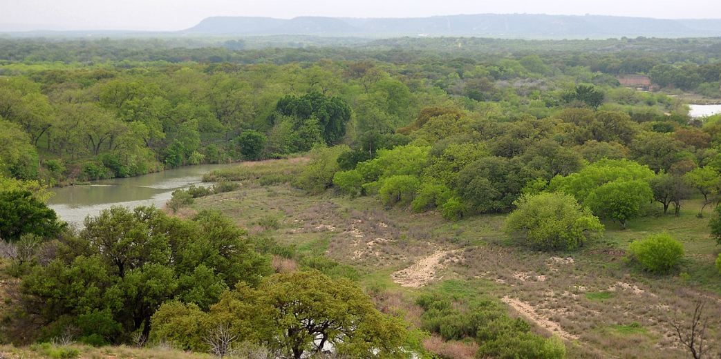
1. The Gulf Coastal Plains

Extending from the Gulf of Mexico inlandto the Balcones Fault and the Eastern Cross Timbers, this large area includes Texas barrier islands. These barrier islands stretch all the way from Paris to San Antonio to Del Rio and feature a wide variety of vegetation. This part of the region gets about 20 to over 58 inches of rain per year. The seaward areas of this part include windblown sands and dunes, oak mottes,grasslands, and salt marshes.
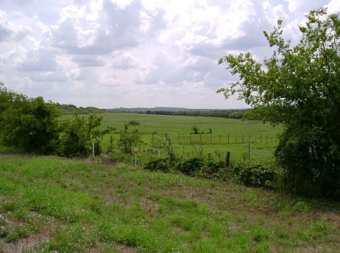
Moreover, the national parks situated in the Gulf Coastal Plains vicinity include Padre Island National Seashore, Big Thicket National Preserve, and the Palo Alto Battlefield National Historic Site. It has a hot, humid climate most of the year and is quite susceptible to hurricane damage in its coastal areas.
The largest city of Texas and the fourth largest of the United States, Houston, is also situated on the Gulf of Mexico.
2. The North-Central Plains
The North-Central Plains are bordered on the south and north by the Colorado and Red rivers,respectively. They are bordered by the Cap Rock Escarpment on the west and the Gulf Coastal Plainon the east. Interestingly, Texas’s second-largest city, Dallas, rests on the border between North-Central Plains and the Gulf Coastal. However, most of the Dallas-Fort Worth Arlington lies inside the North-Central Plains.
This region consists of thick grasses, rolling grasslands, and plenty of limestones. In addition to that, it has lower humidity than most of Texas and gets 20 to 30 inches of rain a year, along with several tornadoes.
We can further divide this region into three regions, including the Grand Prairie, the Cross Timbers, and the Lower Plains.
The Grand Prairie
A majority of the Blackland Prairie’s central portion is on the west by a rise of about 200 to 500 feet in the land. Grand Prairie is surfaced between 600 feet in the north to more than 1,000 feet toward the south. This high elevation is due to the presence of much harder limestone. In this part of the region, soils tend to be thin and rocky or stony. The surface is generally treeless, and the land is rolling to almost hilly.
The area streams are mostly heavily wooded with pecan and walnut.
The Cross Timbers
This part is typically bordered on the west by a forested line of hills. If you are traveling between Austin and Dallas/Ft. Worth, you will see this treeline to the west of I-35. It is actually a very small part, or you can say that it is only the eastern-most extension of the Cross Timbers. The Western Cross Timbers is its larger twin, located to the west of the Grand Prairie.
The Lower Plains
These plains are bounded by the Western Cross Timbers on the east, by the Edwards Plateau on the south, and the High Plains on the west. What distinguishes this area is its wide expanse of flat to very gently rolling terrain. Where streams such as the Colorado and Brazos have cut significant canyons, you can see “breaks” in the surface.
The majority of this part of the region lies between 1,200 and 2,000 feet in elevation. Moreover, the land increases in elevation from the east (approx. 900 feet) to the west (approx. 1,200 feet). On most of the surface in this area, you will find a distinctive red soil; hence the Red River gets its name from the soil washed from The Lower Plains.
3. The Great Plains
The Great Plains extending into the base of the Rocky Mountains, extends from the North-Central Plain on the east to the north and covers most of the Texas Panhandle and westward to the Basin and Range region. There is no vegetation on the surface, and it is noticeably flat. Dust storms are common in this area, and it gets about 16 to 20 inches of rain per year.
Having scorching summers and cold winters, this region of Texas is less welcoming compared to the other parts of the state. Moreover, it has fewer large cities and a lower population density.
We can divide The Great Plains into the following:
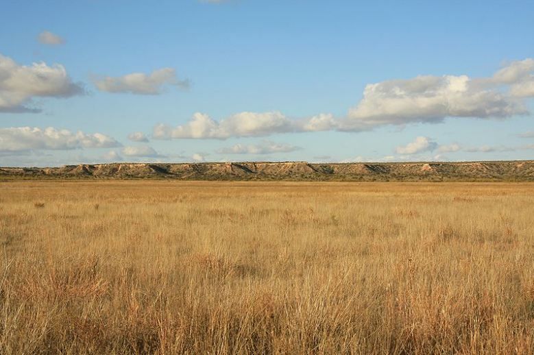
High Plains
As the name suggests, this area of the Great Plains is covered with thick layers of alluvial material. This area is also known as Staked Plains or Llano Estacado. Historians argue on the origin of this name. According to some historians, the name comes from the explorer Coronado who used stakes to mark its route across the trackless ocean of grass so that he doesn’t get lost on its return trip. While other historians say that it takes the nameEstacado from the palisaded appearance of the Caprock.
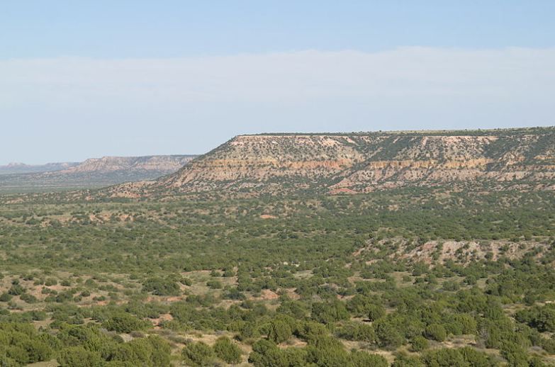
The Caprock Escarpment divides the High Plains and the lower West Texas Rolling Plains. Just like Balcones Escarpment, the Caprock Escarpment rises approx. 200, 500, or almost 1,000 feet above the plains in some places.
Moreover, there arenotable canyons, such as Palo Duro Canyon and Blanco Canyon, as well as breaks along the Canadian River. One can also see a gradual descent of the land’s surface from high to low plains.
The High Plains rise progressively from 2,700 feet on the east to over 4,000 in spots along the New Mexico border. Due to the climate and agriculture differences, the subdivisions are called the North Plains and South Plains. The north plains are known for wheat and grain sorghum farming along with ranching and petroleum developments. On the other hand, the south plains lead the state in cotton production.
Edwards Plateau
Edwards Plateau is the area that is considered the southern and lower extension of the Great Plains. The area lies between the Rio Grande and the Colorado River. It varies from about 750 feet high at its eastern and southern borders to approx. 2,700 feet in places. Almost all the surface is thin, limestone-based soil, covered with medium to thick growth of cedar, mesquite, and small oak. The area is known for growing grass that supports three major industries, including cattle, goat, and sheep raising. Its economy also depends on these three industries.
Hill Country
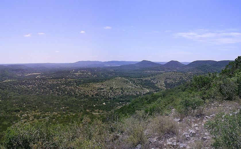
It is a popular name for the eastern portion of this area south to the Llano Basin. Hill Country’s large springs include Barton Springs, Comal Springs, San Marcos Springs as well as several springs in San Antonio.
Hill Country is distinguished by its rugged hills with relatively steep slopes and thin soils.
Toyah Basin
Toyah Basin is located to the northwest of the Edwards and Stockton plateaus. It is a wide flat remnant of an old seafloor. This part of the region has become quite important for many agricultural products due to irrigation. Extra money is added to the economy of this area by local oil fields.
Llano Basin
Lying at the Colorado and Llano rivers’ junction is the “Central Mineral Region,” known today as Llano Basin. This area was known by its former name because it has a large number of minerals.
4. The Basin and Range
This one is the smallest of all four natural regions of Texas. Also known as the Mountains and Basins range, it consists ofseveral drainage basins and Texas’ highest mountains (the Guadalupe Mountains). In this part of Texas, you can find Pecos River and Big Bend National Park. The Basin and Range only get 8 inches of rain a year in the low-lying areas. However, the mountainous area of this region sees about 20 inches of rain each year.
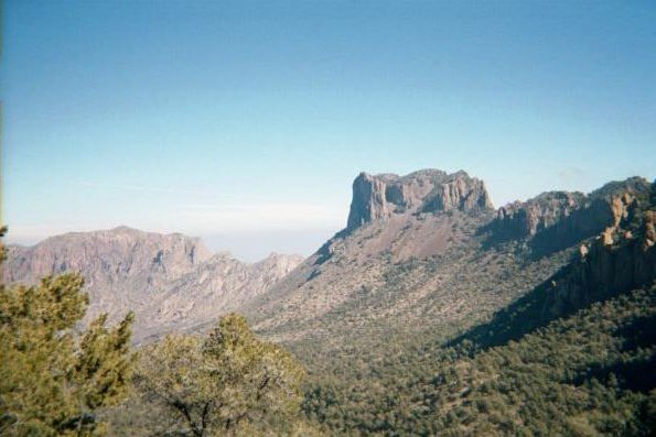
The area includes Sand Hills, desert valleys, wooded mountain slopes, the Stockton Plateau, and desert grasslands. There are over 268 grass species and 447 species of woody plants. The national parks in this area include the Amistad National Recreation Area,Fort Davis National Historic Site, Chamizal National Memorial,Big Bend National Park, Guadalupe Mountains National Park, and the Rio Grande Wild and Scenic River.
Moreover, the area is fascinating in terms of geography as it houses all of Texas’ true mountains. Including:
Guadalupe Mountains
Guadalupe Range is the highest of the Trans-Pecos Mountains. It enters fromTexas from New Mexico and ends 20 miles south of the boundary line where El Capitan and Guadalupe Peak are situated.
The Diablo Plateau or basin is situated west of the Guadalupe Range and extends to the Hueco Mountains. There is no drainage pipe to the sea from this area.
Davis Mountains
This mountain range is located inJeff Davis County. Mount Livermore is the highest of the Davis Mountains, which is alsoone of the highest in Texas. These high mountains touch the moisture-bearing winds and get more precipitation than any other in the Trans-Pecos. Therefore, these mountains have more vegetation compared to other Trans-Pecos mountains.
Big Bend
Big Bend country lies south of the Davis Mountains. This name is given to it because it covers three sides by a great southward swing of the Rio Grande. Due to the area’s excellent topography and plant and animal life, it is home to Big Bend National Park.
Upper Rio Grande Valley
Also known as El Paso Valley, it is a narrow strip of irrigated land that runs down the river for about 75 miles from El Paso. In this part of the region, one can witness historic settlements of San Elizario, Ysleta, and Socorro, which were all founded way back in the 1680s. The major part of this area’s economy is cotton production.
Conclusion
Texas encompasses some of the largest natural regions that are blessed with so many things, including high mountains, streams, lakes, trees, and lots of wheat and cotton. The largest of these four natural regions are the Gulf Coastal Plains, while the smallest one being the Basin and Range.