


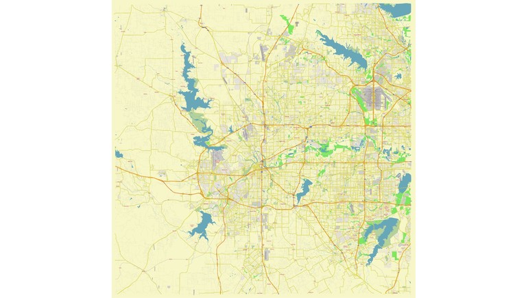
The Fort Worth, Texas Street Map provides a detailed view of the city's road network, neighborhoods, highways, and geographic features. Created in 2024, this modern vector map illustrates the layout of Fort Worth, one of the largest cities in Texas and an important economic and transportation center in the Dallas–Fort Worth metropolitan area.
Understanding Fort Worth's Street Network
Fort Worth is located in North Central Texas and serves as the county seat of Tarrant County. The city has an extensive transportation network connecting residential neighborhoods, commercial districts, industrial areas, and surrounding communities.
The map highlights major streets, highways, and local roads that form the city's transportation system. It also identifies road numbers and place names, making it useful for understanding how different parts of Fort Worth are connected.
Major Highways and Transportation Routes
One of the map's most important features is its representation of Fort Worth's major transportation corridors. Interstate 35W runs north to south through the city, while Interstate 30 provides an important east-west connection toward Dallas and other destinations.
Interstate 20 passes through southern Fort Worth, connecting the city with communities across Texas. Interstate 820 forms a loop around much of the city, helping motorists travel between neighborhoods and major highways.
These transportation routes play an important role in supporting Fort Worth's economy, daily commuting, and regional connections.
Neighborhoods and Geographic Features
The map also illustrates Fort Worth's residential street patterns, developed areas, and natural features. Its detailed road layout shows the differences between the compact street grid of older neighborhoods and the more irregular road networks of newer suburban developments.
Water features and land-use areas provide additional geographic context. The Trinity River, which flows through Fort Worth, has influenced the city's geography, development, and recreational spaces.
A Modern View of Fort Worth
Unlike historical maps that document earlier transportation systems, this 2024 street map provides a relatively recent representation of Fort Worth's urban layout.
Its vector format allows the map to be edited and enlarged without losing image quality, making it useful for geographic studies, urban planning, educational projects, and map design.
The map also provides a reference for comparing Fort Worth's modern transportation network with earlier maps, helping illustrate how the city has expanded over time.
Importance of the Map
The Fort Worth Street Map offers a useful geographic overview of one of Texas's major cities. By showing principal roads, residential streets, highways, waterways, and land-use areas, it helps explain the relationship between transportation infrastructure and urban development.
It also highlights Fort Worth's position as a major transportation hub within North Texas and its connections to the larger Dallas–Fort Worth metropolitan region.